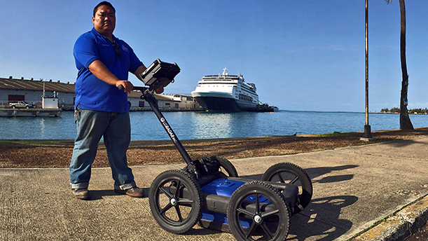
Ground Penetrating Radar (GPR) is the most cost-effective, noninvasive, reliable and easy to use tool for scanning sub-surface soil conditions for buried construction debris, organics, voids, soil raveling/sinkholes, under ground utilities and storage tanks. GPR was primarily used for geology subsurface scanning and imaging. GPR has now developed into a very commonly used tool for many engineering disciplines. The GPR’s multipurpose advantages make it the weapon of choice for investigating subsurface soil conditions.
GPR is always an attractive option for the simple reason of its nondestructive testing methods and turn around time. Foundation Masters, LLC is the top foundation & structural repair/design engineers and contractors in Florida. So who could provide these services better than a company that does the scanning and provides engineering and construction if anything is found. Jeff Earl completes all GPR Scannings so if you feel like theirs an issue with your property’s soil or structure please feel free to call our office with any questions or to schedule your GPR scanning. The turn around time for the GPR Scanning after your site visit is scheduled is one week, then a few days for data collection.
The most significant performance limitation of GPR is in high-conductivity materials such as clay soils and soils that are salt contaminated. Performance is also limited by signal scattering in heterogeneous conditions (e.g. rocky soils).
Other disadvantages of currently available GPR systems include:
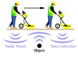
Radar is sensitive to changes in material composition, detecting changes requires movement. When looking through stationary items using surface-penetrating or ground-penetrating radar, the equipment needs to be moved in order for the radar to examine the specified area by looking for differences in material composition. While it can identify items such as pipes, voids, and soil. It cannot identify specific materials, such as gold and precious gems. It can however be useful in providing subsurface mapping of potential gem-bearing pockets, or “vugs.” The readings can be confused by moisture in the ground, and they can’t separate gem-bearing pockets from the non-gem-bearing ones.[12]
When determining depth capabilities, the frequency range of the antenna dictates the size of the antenna and the depth capability. The grid spacing which is scanned is based on the size of the targets that need to be identified and the results required. Typical grid spacing’s can be 1 meter, 3 ft, 5 ft, 10 ft, 20 ft for ground surveys, and for walls and floors 1 inch–1 ft.
The speed at which a radar signal travels is dependent upon the composition of the material being penetrated. The depth to a target is determined based on the amount of time it takes for the radar signal to reflect back to the unit’s antenna. Radar signals travel at different velocities through different types of materials. It is possible to use the depth to a known object to determine a specific velocity and then calibrate the depth calculations.


